
AwesomeEFIS
The AE_83 AwesomeEFIS is a self-contained electronic flight instrument that fits a standard 3 1/8" panel opening.
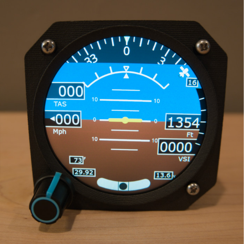
Specs
| Input voltage | 9-36 V DC |
| Current | <100 mA at full brightness |
| Size | 3.35" x 3.35" x 1.75" |
| Weight | 125 grams |
| Max altitude | 30,000 ft |
| GNSS | Receiver with WAAS |
| Screen | 2.8", 480x480 resolution |
Max airspeed
| Model | Max airspeed |
|---|---|
| Low speed EFIS | 240 mph (208 knots) |
| High speed EFIS | 340 mph (295 knots) |
| Really high speed EFIS | 430 mph (370 knots) |
What's in the box
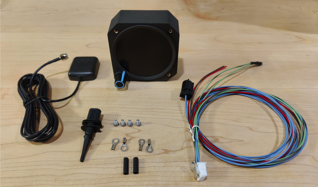
- AwesomeEFIS (AE_83)
- GNSS antenna
- Wiring harness, terminated
- Ring terminals (2 sizes) with heat shrink
- Outside air temperature (OAT) sensor
- Grommet for OAT sensor mounting
- 3x mounting screws, 6-32 x 1/4"
Important notes
Connect the GNSS antenna before powering on
Powering the EFIS without the GNSS antenna connected is not recommended. It can damage the amplifier and input circuit.
Note
Voltage is not displayed when powered from USB.
Device overview
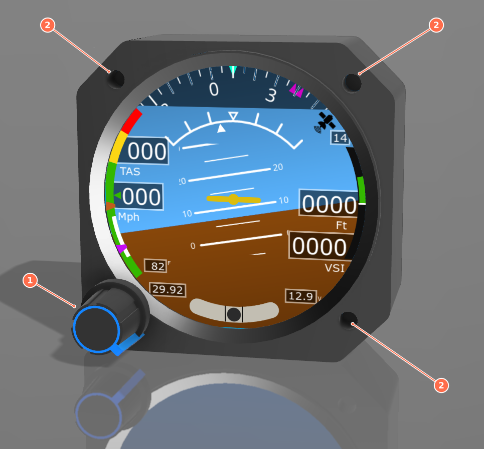
Front
- Rotary encoder: turn and press to use the menus.
- Mounting holes: for the supplied 6-32 x 1/4" screws.
Rear
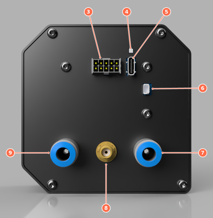
Numbered clockwise from the top left:
- Input connector
- Status LED
- USB-C connector
- External LED connector
- Static port
- GNSS antenna connector
- Pitot port
Display elements
The elements on the primary flight display are numbered clockwise, starting at the top left of the compass.
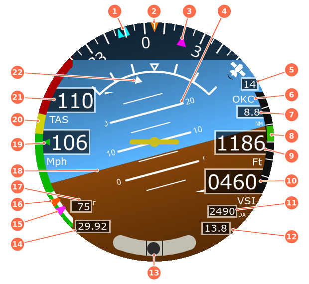
- Heading bug: double cyan triangles.
- Heading indicator: the orange pointer marks the current heading. Either magnetic heading or GPS track.
- Course bug: magenta triangle. During direct-to navigation it shows the course to the destination.
- Pitch ladder
- GNSS satellites tracked
- Destination identifier: the airport you are navigating to with Direct To.
- Distance to destination
- VSI trend graph
- Altitude (MSL)
- Vertical speed
- Density altitude: can be turned off with Show Density Altitude in Configuration.
- Aircraft voltage: the background turns yellow or red when voltage is outside its limits.
- Slip / skid ball
- Altimeter setting
- Approach speed
- Gear extension speed
- Outside air temperature
- Horizon
- Indicated airspeed
- Airspeed tape: colored arcs for the green, yellow and red airspeed ranges.
- True airspeed
- Roll indicator